Showing posts with label Running Routes. Show all posts

Sunday, September 27, 2015

Post race: Revisiting Adelaide Marathon 2015 route

Next day after the marathon I had a chance to walk the torrens again.

Map of river torrens at Elder Park
Before sunset, I walked along the river. I have plenty of time to look at the surrounding. One by one, I recognized, I recalled. It was like remembering the good memory and able to identified it. The route was filled with people the day before, now it was all empty and quiet. There's only trees, river, architecture, duck and occasional cyclist and people. The run? It's like never happen.
Adelaide Oval is within sight. Music and speaker noise could be hear from there during the race day

Let's look at some spot that I able to recognize.


The bridge. Situated at 7km and 27km. There is a parking lot after the bridge. On race day, the route leads towards residential area, then run back again, but turn left away from the bridge to continue path at river torrents.
Took this photo after a group of evening runners past by. 

This is how direction was drawn on the road. However the arrows was sufficient at each junction and did not cause confusion.

The bridge near university that runners run under it

One section of the road that unable to view the next turn.

Nice path in the evening. On the race day, it was with people and occasionally biker and pets.


Past here about half way and towards the end. 

Running direction from the left, up to the white building and into the bridge to finish.


Wednesday, December 18, 2013

Reservoir Park - Kuching, Sarawak

I visited Kuching on Sept 2013 and went for running in Reservoir Park, Kuching. Got this information by posting question on a Sarawak's runners blog. They provided a few routes around Kuching but it's not suitable for me to run in the evening as it's road with traffic.

The park is almost similar to Botanical Garden, Penang and Bukit Serindit Recreational Park, Melaka. Place of local folks gathering for outdoor activities, frequent by runners. One can choose to run flat path around the lake, or take longer loop with mild elevation. There are few path with staircase that linked which allow one to make small hike around the higher ground of the park.


Signage at one of the entrance 

The park plan
Another entrace


The signature China bridge
The path around the lake

The view from another side 

The larger loop with mild elevation (going down from this view)

The advantages of running in a park are fresh air and free from traffic


The path on the higher ground  around the park provide small hike


Thursday, August 8, 2013

Padang along Lebuhraya Rose, Penang - 0.6 km

Padang (field) along Lebuhraya Rose is the first location I do my running.

It is located opposite the rear entrance of Penang Adventist Hospital.

There's a hawker center nearby.

Mostly every evening, there's be people playing football on the field. 

The other activities that also happening include school team football training, walking a dog, herding of cattle across the field for food, and occasionally golf training (although a sign board stated that golf training is prohibited on that gound).

Running is not popular here. 


The surface around the field is uneven. There are tree roots emerge along running path, and there are sunken ground that covered by grasses. Extra precaution is needed when running here. Run slow if one first try out the place. It used to have cow's dung when the cattle pass here, and dog feces too. I'm not sure of it now. I seldom visit the place nowadays.

It is a good place for the people in the neighborhood to do sports and outdoor activities. 

I love this field as it is one of the place I started to train for running. 

Morning footballer

One of my photography lover friend impressed by this old tree beside the field.

A view from the side
Another view from the side. 
Running trail could be seen.
A view from the end of the field.

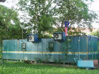
The municipal staffs office is beside the field. The air-conditioner split units are carefully protected from being stolen.


Tuesday, October 2, 2012

Running Spot in Melaka: Bukit Serindit Recreational Park

I recently spent a weekend at Melaka and found from friends on this good place for running.
It situated adjacent to Stadium Tun Fatimah and in fact the name as become synonym to this place.

Below are the view from the goggle map.

The park has a combination of tar road (flat) and hilly path. It's more convenience to run on the tar road that include a to and fro. It has designated sign board to suggest the route to go one 2.2 km loop. It's very tricky at one turn that need to run out of road into trail and I only success to figure out on my 5th or 6th try, still I only manage to track 2.1 km.

Sign that showed suggested loop for 2.2 km and estimation for calories burn each loop
"Congratulation", it says, "You have reach 1.0km and walk 1600 steps"
2.0 km point or 3200 steps
There are other activities going on at this place including aerobic, basket ball and hockey. One can run here all day but there are some area without enough lighting when it's dark. It's better run on tar road and avoid the garden area as there are some uncovered drain along the way. Be aware also the tree roots on the trail that tripped me even though I'm aware of them.


Saturday, August 18, 2012

Padang Polo, Georgetown, Penang (1km)

 
Padang Polo is a big and beautiful field located opposite Penang General Hospital.
Most evening will be filled by soccer players and other activities on weekend.
It is not a common place for joggers and runners (as compared to Botanical Garden) but some regular runners will always be seen most of the days.
The field is also the starting point for some event such as the annual Around the Houses Relay.

There were mild elevation on one side of field and mild declination on the other.
The surface was relatively flat but beware of some tree root that lay in the way.
The soft surface is good to give the tired leg a change after getting bored to the hard surface of tar road.

The field is accessible 24 hours but the field will be totally dark after sun set as there's no lighting facilities.


Thursday, March 15, 2012

Botanical Garden (long loop), Penang - 1.9 km


The bigger loop.
Challenging hill profile for about 300m-400m of distance.
Suitable for hill train.

Botanical Garden (small loop), Penang - 0.9 km


Promoted by state government as a tourist spot, also a famous recreational ground of Penangites.
Popular running spot.
There are people running all day long.
Expect crowd during weekend and public holidays.
Suitable time to go: anytime when you see the daylight. Gate closed at night at uncertain hour. I once stayed till 9++pm, but I also unable to enter at around 8.15pm on a rainy night.
Medium hill elevation, suitable for easy run, hill train.
If you seek for a more challenging hill profile, you can find it by running the bigger loop.

The magnificent tree marks the entrance.
Take the left from the entrance is this road, where the commuter will park on usual day for passenger.
It used to be a famous place for "mandi", now has become less popular. 
The start of the bigger loop, elevation about 30 m if my GPS is accurate.
Look backward and see this view.

There's be a short flat road after the tent.

Another mild elevation start here. 

Something for sight seeing: The water treatment plant.

The descend. 


Descend continue. I can't take this descend well it's steeped for me.

Path cut through the garden.
Approaching the end of the loop.

Some new decoration built to make the place more attractive. 
(Added photos on 15 Dec 2013)